Where is it flooding?
National Weather Service River Forecast centers list rivers that are flooding or predicted to flood soon. Here is a list of the regional centers: http://water.weather.gov/ahps/rfc/rfc.php
For example, the California Nevada River Forecast Center is here: http://www.cnrfc.noaa.gov/
Each regional center web site has a summary section like this:
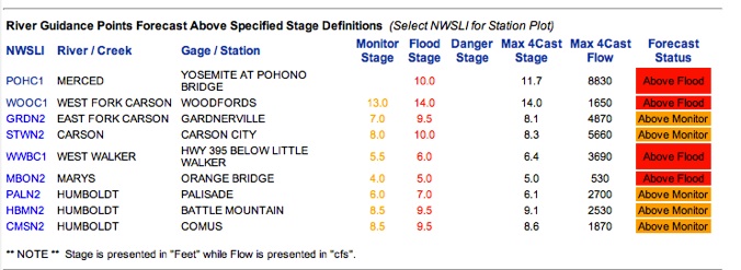
Click on an entry in the left hand column, and you will be taken to a page showing details about it, including its flood levels and site location. Scroll to the bottom of the details page, and you’ll see this:
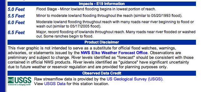
Finally, click on the “USGS Data” to be taken to the corresponding USGS gaging site.
To load this useful data into Streamflow Plus, follow these steps:
-
- Open the Settings tab, select your state, and enter the USGS station number in
the search box. Select it to make it the current site.
- Load flood stages from the NWS “Impacts” section on the “Levels” tab using “Add Level”.
- Finally, save your work by clicking the Favorites tab, then “Add to Favorites”.